Proton AG incorrectly showing the wrong Indian map in its apps

rootyme

Disciple
Look at what they have done with Jammu and Kashmir. Can somebody tell me why they are doing this?

As pointed out by a fellow member, OpenStreetMaps is likely responsible for this. https://www.openstreetmap.org/relation/304716#map=5/21.841/82.683

1000024117.png
 
Last edited:
https://support.google.com/maps/answer/3145721?hl=en-IM
"When exploring the world on Google Maps, you might see different styles, borders and labels."

Quoting from that Google support page:

Disputed boundaries​

Disputed boundaries are displayed as a dashed grey line. The places involved don't agree on a boundary.
There are no lines in the Proton map which suggest that they have done this specifically to indicate a dispute.

What's shocking is people use free services and still complain.
What kind of response is this mate? This thread is not regarding the VPN quality.
 
Last edited:
There are no lines in the Proton map which suggest that they gave done this specifically to indicate a dispute.
India highlighted here, i.e, the Proton App, looks like an image and not dynamically generated. While getting dynamically generated, during the app compile process, Google APIs return the country boundries wrt the source IP, and in this case it might be a server located in the EU or US. When you visit Google Maps from EU or US or any non-India IP address, you can see that the boundary is not what you see while visiting from India.

Regarding the map generated, it is upto the developer (Proton), how they want to generate the map, whether to include all features or just the boundary.

Since, they have not included the states' boundries, I refuse to use their application
 
India highlighted here, i.e, the Proton App, looks like an image and not dynamically generated.
Exactly.

When you visit Google Maps from EU or US or any non-India IP address, you can see that the boundary is not what you see while visiting from India.
Just confirmed this. They basically indicate the entirety of J&K as disputed. But the dashed lines do cover the entire state as they should.

Regarding the map generated, it is upto the developer (Proton), how they want to generate the map, whether to include all features or just the boundary.
Not just the POK part, they have shown parts of J&K as completely Chinese territory. No small err this. Looks like OpenStreetMaps is to blame. Proton should've been more responsible still. Hopefully it gets fixed.

Since, they have not included the states' boundries, I refuse to use their application
Glad that I didn't have another memebr tell me that I shouldn't complain about free services.
 
Last edited:
Looks like they are using OpenStreetMap to generate the image as seen in the attachment. Here is the source: https://www.openstreetmap.org/relation/304716#map=5/21.841/82.683

To get the right map, one could do the following:
  • Suggest edits to OpenStreetMap and get it approved by the maintainer
  • Send a notice to Proton AG. But they won't respond as the notice does not have legal standing in Switzerland, where the company is based
  • Lodge a complaint with Ministry of Electronics and Information Technology and ban Proton AG from operating in India. Here is how to do it: https://services.india.gov.in/servi...try-of-electronics-and-information-technology
 

Attachments

  • 1712979655087.png
    1712979655087.png
    700.7 KB · Views: 17
I would like to ask something genuinely non-ironically.

Why is this such a big issue? The map is being used in a non-functional way (i.e. it's not a maps application). It does not affect the utility of the application. What is so offensive about this. I genuinely want to understand.

We all know that Kashmir is disputed territory. If you've ever purchased a foreign printed atlas or encyclopaedia you are aware that Customs often stamps or outright redacts "incorrect" maps of India. With the Internet, it's impossible for the government to "fix" every map.

Similarly, not every app developer will take the time to make sure the app shows the official government approved map of a country to users within that country. This does not look like some big conspiracy to deliberately give Indians the finger.
 
Looks like they are using OpenStreetMap to generate the image as seen in the attachment. Here is the source: https://www.openstreetmap.org/relation/304716#map=5/21.841/82.683
Okay so how on earth is this acceptable?

We all know that Kashmir is disputed territory. If you've ever purchased a foreign printed atlas or encyclopaedia you are aware that Customs often stamps or outright redacts "incorrect" maps of India. With the Internet, it's impossible for the government to "fix" every map.

Similarly, not every app developer will take the time to make sure the app shows the official government approved map of a country to users within that country. This does not look like some big conspiracy to deliberately give Indians the finger.
Thanks to valar007, we've now reached at the actual source of this (probably). You're correct about the fact that ProtonVPN is not a maps app. But it is a VPN app which absolutely depends on various countries to advertise its servers. VPN exists as a workaround for geo-blocking.

When you advertise that you've servers in India, it's your responsibility to ensure that you show the correct map. Are you going to say that the regions of J&K that they have shown as completely Chinese, have Twitter and Facebook blocked since 2009? No, right? It's misleading, literally!

What do you think about OpenStreetMaps then? It is an exclusively maps platform yet it shows the wrong map!

Edit: They don't have servers in India. https://protonvpn.com/blog/servers-india/
 
Last edited:
What do you think about OpenStreetMaps then? It is an exclusively maps platform yet it shows the wrong map!
OST is a free resource and run by a non-profit, similar to Wikipedia. You can probably understand if they choose not to spend their limited resources on showing users different variants of maps based on which country they're accessing it from. I don't think it is malicious intent.
Are you going to say that the regions of J&K that they have shown as completely Chinese, have Twitter and Facebook blocked since 2009? No, right? It's misleading, literally!
You are correct that it is misleading but it is so in probably a very harmless way. If I was interested to know if a particular border town in Kashmir has social media access, I am not likely to use an illustrative map in a VPN app to source that information.

My point is that unless someone has some work specifically involving the accuracy of international borders, a map that serves as nothing more than a UI element should not cause any serious offence. Imagine if instead of a map it was a simple dropdown list. Or if it was a cartoonified map the way TunnelBear does it.

Edit: fixed some grammar
 
Okay so how on earth is this acceptable?
Because as the name suggests OpenStreetMap is a geographic database updated and maintained by a community of volunteers via open collaboration. They are just following what all countries publish.
India -> publishes it's official map, get's added to the database
China -> publishes it's official map, get's added to the database
Pakistan -> publishes it's official map, get's added to the database
Bhutan -> publishes it's official map, get's added to the database

Any overlapping areas are classifed as disputed areas and hence the dotted international boundary. They are not following any agenda. They are not controlled by any country. They are present because of the monopolistic nature of Big Tech like Google (this is a completely different topic). They are there to provide a free service without any strings attached. They are not the direction you should be finding fault with

When you advertise that you've servers in India
Proton does not have servers in India so you are not using any service hosted in India and hence not bound by Indian laws. Source: https://protonvpn.com/blog/servers-india/
 
My point is that unless someone has some work specifically involving the accuracy of international borders, a map that serves as nothing more than a UI element should not cause any serious offence. Imagine if instead of a map it was a simple dropdown list. Or if it was a cartoonified map the way TunnelBear does it.
Agree with you. Have edited the thread title and the OP and my second reply now.

Because as the name suggests OpenStreetMap is a geographic database updated and maintained by a community of volunteers via open collaboration. They are just following what all countries publish.
India -> publishes it's official map, get's added to the database
China -> publishes it's official map, get's added to the database
Pakistan -> publishes it's official map, get's added to the database
Bhutan -> publishes it's official map, get's added to the database

Any overlapping areas are classifed as disputed areas and hence the dotted international boundary. They are not following any agenda. They are not controlled by any country. They are present because of the monopolistic nature of Big Tech like Google (this is a completely different topic). They are there to provide a free service without any strings attached. They are not the direction you should be finding fault with
Noted. :)

Will Proton fix this if anybody mails them regarding the same?
 
Will Proton fix this if anybody mails them regarding the same?
They might they might not. Doesn't hurt to drop an email

Related incident. There was an application launched by one of the WITCH companies in India that help university students obtain certifications in Python, Java, etc. When it was launched, I was able to access KeyCloak IAM application. It was exposed to the internet. I could see 2+ lakh student details with personally identifiable information, which college they go to, and other details. I dropped an email to them, explaining the steps on how to replicate it. Asked them to fix it ASAP. 2-3 weeks go by. No response. Not fixed. I was able to get in touch with a senior level employee and explain the issue. It got fixed in 6 hours. What I got in return? A water bottle and pen. My learning: companies might not respond to emails asking to fix something. Don't expect a reply as well. Have 0 expectations
 
The purpose of this thread was not to bash Proton AG. I created it since I thought it was irresponsible from a company to have a map like that in its apps. Part of that thought process was my lack of knowledge that they source these from OSM. Again, I had never seen the OSM version of India before today.

In hindsight, I should've worded it more neutrally I reckon. Let's not escalate this into something which it was not meant to be.

If we dig into history, Kashmir has been a troubled state for way too long and it has seen too much trouble. To point at the internet blockage would be inviting even worse stuff from the bygone times.

I fear this is going to take a political turn from here onwards. I'm out.
 
Oh there is news. With the newer versions of ProtonVPN (On Androids at least), you no longer have the option to pick the country/server of your choice.

To repeat, you get a grand total of one connect button and you're at the mercy of the app to automatically select a country for you.

I know this is free service, but there was no reason to do this.

Edit: You can technically still change the server. But there is a timer of 90 secs. After that, the app picks the random server for you. You need to pay should you want any control over this.
 
Last edited:
Why is this such a big issue? The map is being used in a non-functional way (i.e. it's not a maps application). It does not affect the utility of the application. What is so offensive about this. I genuinely want to understand.
Every kid in school sees a map of J&K that looks a certain way since the 50s. So when it appears different it is jarring.
We all know that Kashmir is disputed territory
Not in India. We're quite clear where the state's borders are. It is disputed or shall we say falsely claimed by the two neighbours. Indians should never refer to this area as disputed as it gives undue credence to the false claims of the other two. All of J&K, including parts presently illegally occupied by others are an integral part of India.

Geographically Kashmir is a small part of the state of J&K. But people outside refer to ALL of J&K as Kashmir as if Jammu & Ladakh don't exist.

Only a tiny sliver of Kashmir is missing. To the west of Kashmir is an area known as Mirpur. The much larger missing parts are from Ladakh in the east and gilgit baltistan (GB) in the west.

To this day, there are empty seats in parliament for reps that would have come from these areas. We live under the belief these areas will return to the union in the future.
This does not look like some big conspiracy to deliberately give Indians the finger.
Somebody should point it out to them. That people from a big market are free to choose what apps they want.
 
Last edited:
Every kid in school sees a map of J&K that looks a certain way since the 50s. So when it appears different it is jarring.

Not in India. We're quite clear where the state's borders are. It is disputed or shall we say falsely claimed by the two neighbours. Indians should never refer to it as disputed as it's giving undue credence to the false claims of the other two. All of J&K, including parts presently illegally occupied are an integral part of India.
This best explains what I felt when I first saw that map. I found it shocking since I had never seen anything like that. In my book, the entire state belongs to India and nothing can change that pov. I still don't get why people in US and EU see a different map of India than what we Indians see.

I have received a wide range of reactions to my post. The reaction "complaining about free services" was strange. But something else was even stranger. The person right above my "I'm out" post linked to m1tr's bu**hurt remark here on this thread writing that his remark stands "confirmed". The J&K internet blocking/shutdown topic was also brought up out of nowhere!

Before you, Valar and I were the two people who took a issue with the distorted map so I am assuming that I was a subject of that commentary. First, I checked my bu**, found it safe and sound; second, I posted that I didn't want politics here. Goes to show easily people generalise. The other post was regarding a troll post on social media and this one is regarding a distorted national map. Apples and oranges.

The OSM map is there, yes, but we still don't know if this is intentional or not. Proton needn't show different maps to different users since J&K does belong to India. Is this a big deal? For most Indians it can be unless I am wrong in assuming this. As Indians, to the best of my belief, most would prefer being greeted with correct map every single time they launch the app instead of the distorted one.

That being said, I was in the wrong to write that Proton has done this "purposefully". We don't know and we can't accuse without any confirmation. To repeat, this thread is neither a critique of the quality of Proton apps nor a bashing of Proton AG.
 
Last edited:
This best explains what I felt when I first saw that map. I found it shocking since I had never seen anything like that. In my book, the entire state belongs to India and nothing can change that pov. I still don't get why people in US and EU see a different map of India than what we Indians see.
Because they don't know the whole story. The Radcliffe line at partition cuts out J&K entirely and awards it to Pakistan which is the basis of the Pak claim. The understanding of people abroad ends there.

But as you know the ruler Hari Singh didn't consent to joining either side. So underhand methods were used. A British major got things going by raising the Pakistan flag in the GB area. This began the Pak land grab and Hari Singh asked Nehru for help which would be forthcoming provided he agreed to accede his kingdom to India. Nothing new as over five hundred princely states had been through the same process. He agreed and thus began the military operations to defend the area. At the end a large portion of GB and Mirpur remained in Pakistan's control. It's worth studying this conflict as short of some truly heroic actions for which the first PVC's were awarded we never would have regained any of J&K. There's some new books out that have go into more detail than was previously known.

There's quite a bit of criticism of the way how Nehru then chose to resolve the matter by approaching the UN as it was widely believed the Indian military could recover the occupied territory in a matter of weeks.

Nehru's idea of going to the UN was to get international recognition of J&K as part of India. In effect reverse the British decision to award entire J&K to Pakistan.

Otherwise it would look like an Indian land grab and bring into question the legitimacy of whatever parts of J&K India held at that point. The Brits drew the borders so who's to say the Indians wouldn't violate them again and claim more elsewhere.

A ceasefire was agreed at the UN and after a plebiscite was to be held. Before the plebiscite was to take place. The Pak side had to withdraw their forces first followed by the Indian side. Well, the Pak side never withdrew and that's where the matter ended. Thereby allowing India to remain in J&K as the terms of holding the plebiscite were never complied with by Pakistan.

So the reality is Pakistan failed to abide by the conditions of the plebiscite, an important fact they always forget to mention when claiming the entirety of J&K and saying plebiscite was never held and needs to be held now after they demographically re-engineered their part with Punjabis.

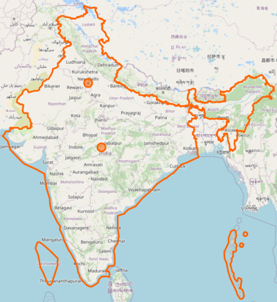
The Ladakh part was lost during the '62 war as we failed to prevent the road construction the Chinese initiated through Aksai Chin during the 50s to link Xianjiang with Tibet. The only way to link the two regions was to go through Aksai Chin. An area that owes nothing to the Brits and was won by dogra kings much earlier.
The J&K internet shutdown topic was also brought up out of nowhere!
Where
second, I posted that I didn't want politics here.
Have I done that? I don't know any other way to answer your question then.
The OSM map is there, yes, but we still don't know if this is intentional or not. Proton needn't show different maps to different users since J&K does belong to India. Is this a big deal? For most Indians it can be unless I am wrong in assuming this.
It is a big deal and even bigger when standing in Ladakh your location shows up as in China as occurred with Google services a while back.
That being said, I was in the wrong to write that Proton has done this "purposefully". We don't know and we can't accuse without any confirmation. To repeat, this thread is neither a critique of the quality of Proton apps nor a bashing of Proton AG.
It's probably an oversight which should be brought to their notice.
 
Last edited:
Back
Top